Fall is officially here. Thanks to the roughly 23-degree tilt in Earth’s axis, the days are now growing shorter and colder in the northern hemisphere. That means deciduous trees are shedding their green chlorophyll and giving us a peek at the reds, oranges, golds, and browns they’ve been hiding all year.
While peak leaf-peeping season depends on latitude and weather conditions throughout the year, you don’t have to travel far to see the best autumn hues. In fact, you don’t have to travel at all. NASA satellites observe the Earth year-round and we’ve collected some of the best photos they’ve snapped of brilliant fall foliage.
This image of Nunavut, the northernmost reaches of Canada, was captured on September 6, 2006 by the Earth observation satellite Landsat 9. Because it’s so close to the North Pole, plants in this region, which include tundra flora like willow, birch, and blueberry shrubs, change colors earlier than other parts of the continent, and may now already be past their peak. Credit: NASA/Michala GarrisonFall reaches northern states like Minnesota, Wisconsin, and Michigan first in the United States. As you can see in this photo captured by NOAA-20 on September 22, 2020, evergreens thrive along the banks of Lake Superior due to the lake effect, which creates a relatively chillier microclimate. A bit further inland are maple, birch, and aspen trees, which change their colors in the fall. Credit: NASA
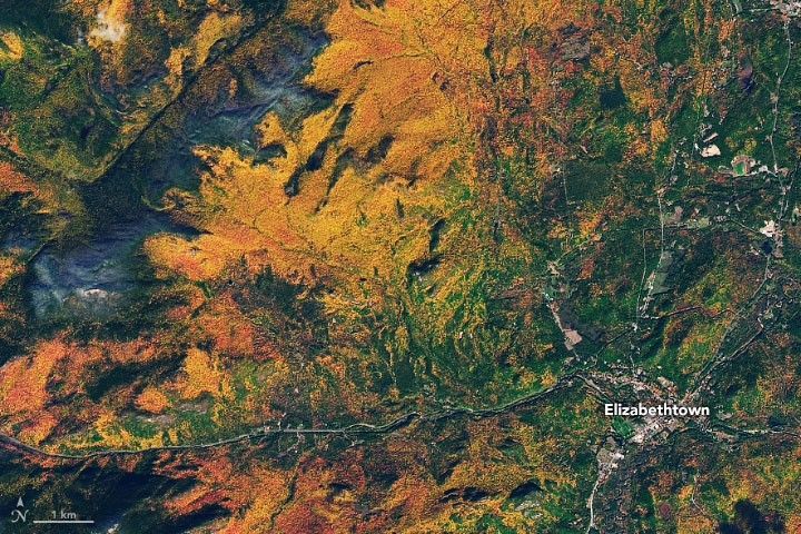
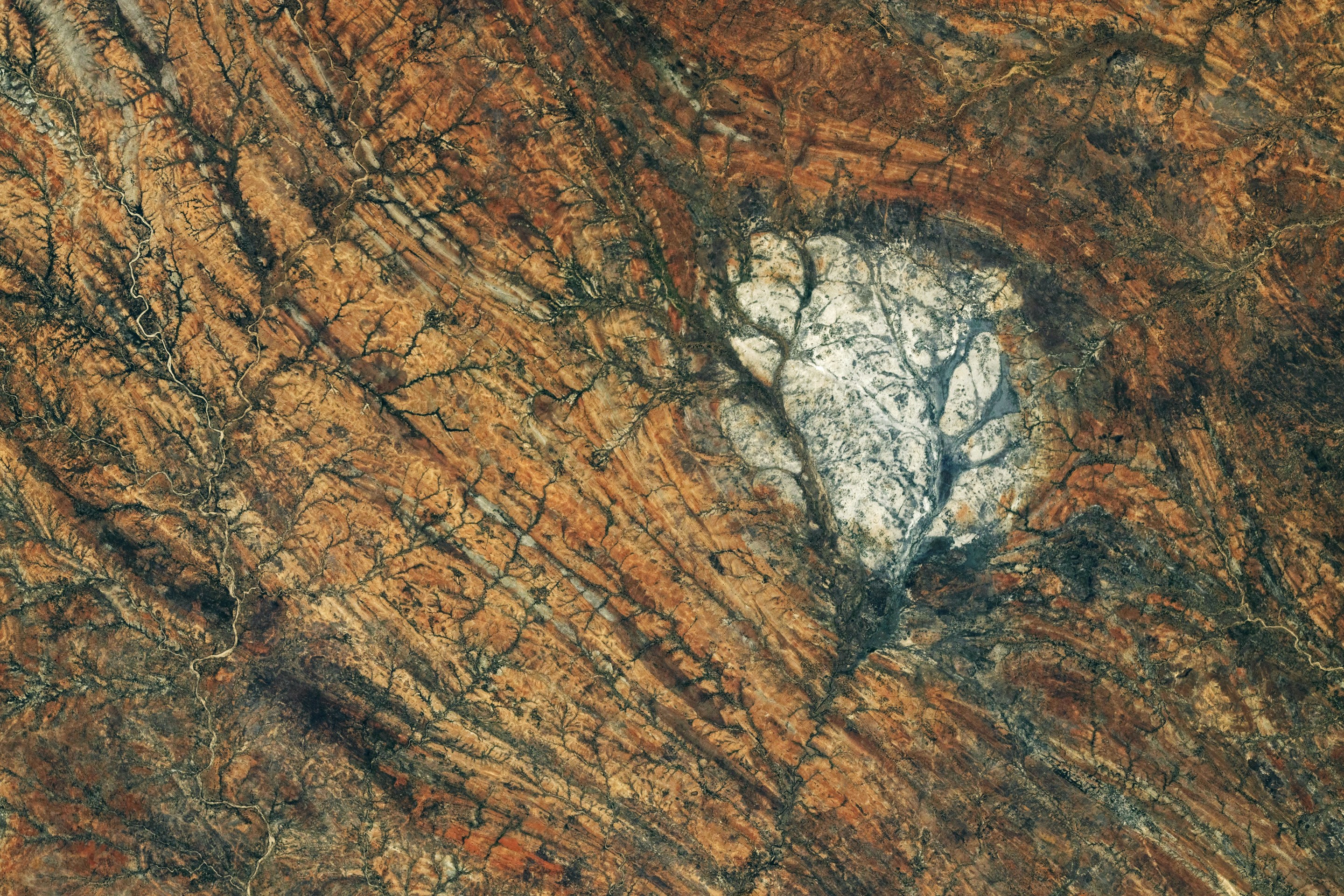
Of course, autumn comes to the Southern Hemisphere much earlier in the year. This image of Chile’s Magallanes region, captured in April of 2026, shows one of Earth’s southernmost temperate forests. In the fall, the leaves of the southern beech trees can vary in color from blazing yellow to scarlet red. Credit: NASA/Lauren Dauphin 2022 may have been a disappointing year for leaf-peepers, as drought conditions across the northeast stressed trees, dulling their vibrant autumn hues. However, the red maples, quaking aspens, and Eastern larches populating the Adirondack Mountains outside Elizabethtown, New York, apparently didn’t get the message. Credit: NASA/Joshua StevensA photo of Mount Katahdin, the highest point in Maine, taken by the Landsat 8 satellite on October 13, 2017. At almost 5,270-feet-tall, the peak of this mountain is too high to support large plants like trees, which is why it appears brown. Further down, evergreen trees on its slopes give way to deciduous species with leaves that change to a blazing golden color. Credit: NASA/Joshua StevensThe foliage dappling the folded mountains of central Pennsylvania (photographed by the Landsat 8 satellite on November 9, 2020) are a bit past their peak here, but still beautiful. The forests are primarily populated with red and white oaks, which turn a russet brown. The rippling mountains were formed by plate collisions that occurred over 440 million years ago during the Ordovician Period and are some of the oldest in the world. Credit: NASA/Joshua Stevens
Due to frequent storm cover, Alaska can be tough to photograph from above during autumn months, but the clouds parted long enough for Landsat 8 to snap this picture of the winding Snake and Weary rivers on September 29, 2017. The golden tones likely come from aspen, birch, and balsam poplar trees surrounded by evergreens. Credit: NASA/Joshua StevensIn Japan, leaf peeping is called Momijiari, which translates to “red leaf hunting.” There the volcanic Mount Aso erupted in 2021, prompting Japanese officials to warn the public to keep at least one kilometer away. Of course, Landsat 8 was able to snap this photo from a much safer distance. The brilliant yellow colors likely comes from a mix of trees and grasses. Credit: NASA/Lauren Dauphin