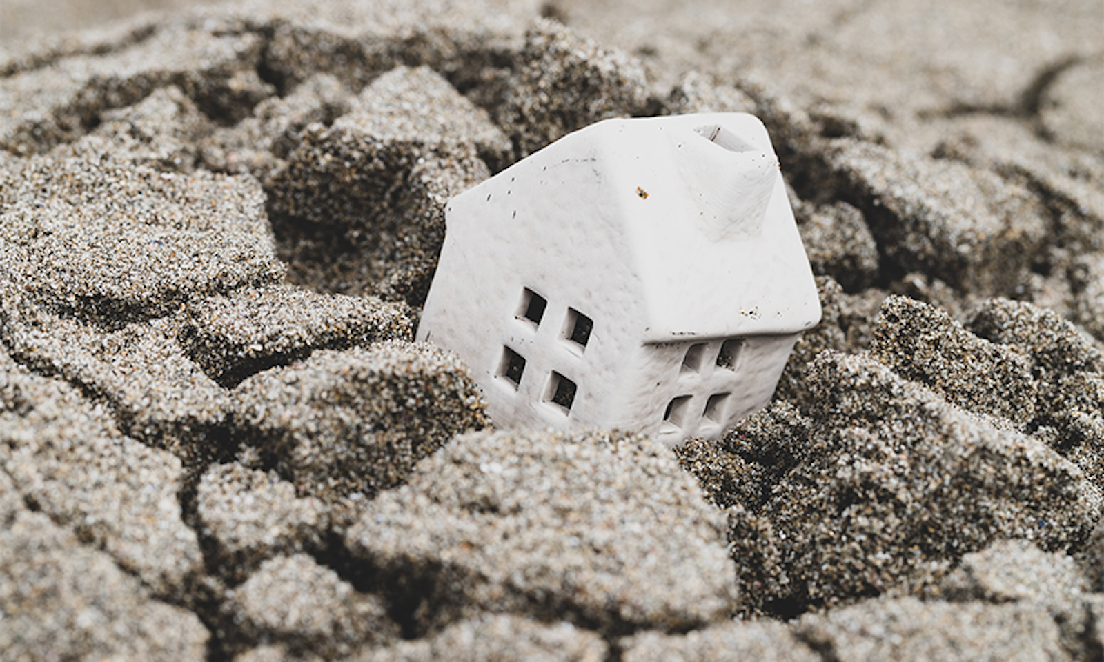
Soft sheets of gray rain swept across the steep hills of Astoria, Oregon, on the last Saturday of January 2024, the mizzle a comforting patter on the roof. It was one of the few days Adrienne Fabrique was able to sleep in, a respite from the constant demands of running a small property management company. But her dogs started barking, and soon, there was a loud knock. She opened the door to a police officer. He told Fabrique a slow-moving landslide had begun in the neighborhood overnight, and within a few hours, she had to evacuate.
The word “landslide” typically conjures images of mud and rock rushing down a slope, burying or destroying anything in its path within moments. Survivors talk about hearing the thunder of the earth rushing toward them as the only warning of an impending calamity. These rapid disasters are typically caused by the top layers of soil losing their hold. But slow-moving landslides are often generated by a deeper split, resulting in larger cleavages that can move at much subtler rates, from a millimeter to a few meters a year.
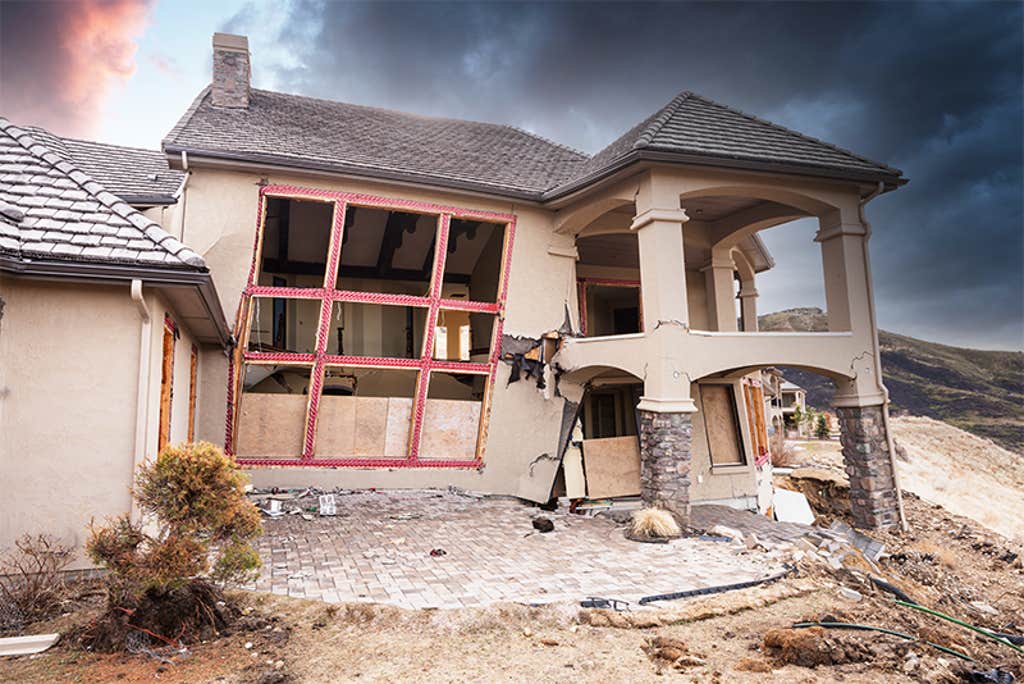
Some houses have moved so much they’ve technically migrated onto someone else’s lot.
Even these plodding slides, however, like the one threatening Fabrique’s house, can have catastrophic impacts on buildings and infrastructure. Natural gas and water to her street were soon shut off, and cracks emerged in the pavement.
Most of Astoria is prone to this kind of hazard. The picturesque city of about 10,000 people—and setting to many films, including The Goonies—was raised on a peninsula overlooking the mouth of the Columbia River. Its precipitous slopes rise over unstable soil. When it rains, as it does frequently, the water table swells, spilling over the bedrock into the clay above it—which often begins to slip downhill.
As a result, over the past 150 years, the city has recorded at least 80 landslides—more than a third of which are deemed “deep” slides, often of the slower-moving variety. In fact, the hill Fabrique’s house perched on had fallen before. It was part of a slow-moving landslide in 1970, as well as an earlier one in 1950. “This area is known to slide almost in the exact same shape, each time,” says Brian McCarthy, the city’s deputy fire chief and emergency manager. For the past several weeks, the area has drifted approximately an eighth of an inch a day—far slower than the debris flow that killed 43 people in nearby Washington in 2014, but plenty forceful to knock a building off its foundation or to crush underground pipelines. These slower slides can also accelerate rapidly and unexpectedly, creating new hazards.
These creeping disasters are poised to multiply—and possibly accelerate—with climate change. They already occur throughout the world, cropping up on every continent, and have long plagued the American West Coast.
In California alone, there are more than 650 active slow slides. Take, for example, Rancho Palos Verdes, California, a wealthy community south of Los Angeles where dramatic palm-lined cliffs fall into the breakers. A slide that began there in 1956 is still moving across about a tenth of the city today. Its progress recently accelerated after last year’s atmospheric rivers, destroying 12 homes in 2023. The city has been hard-pressed to cope; after a moratorium on building in the area, residents of the luxury community have responded with ad-hoc repairs, constructing makeshift foundations near the above-ground sewer lines. Some buildings have moved so much that their geographic coordinates no longer match their legal description, the houses technically migrating onto someone else’s lot.
Landslides are possible anywhere there’s a slope, though they are more common in places where the land is uplifting at the same time as rivers or erosion are downcutting—which describes much of the West Coast. But scientists are still debating why some earthflows move more quickly than others. Bill Schulz, a research geologist at the U.S. Geological Survey, says, “meteorological processes, like rainfall, help to determine whether landslides are going to occur, and material conditions determine what those slides are like.”
Many previous studies have found that slides are strongly correlated with groundwater. This seems to hold true in both wet and dry climates. Scientists at NASA’s Jet Propulsion Laboratory recently found that slopes in northern California and those in the arid borderlands are both sensitive to extended wet periods and high-intensity storms. Yet the effects aren’t always immediate; slow slides can begin months or even years after heavy rainfall.
The answer to why may lie far below the surface. Much of California, for example, consists of a rock type called Franciscan Melange, which has a high clay content. Unlike granite, when clay-rich material fails, its strength decreases comparatively little, so it tends to move more slowly. Clay also swells when it gets wet. Schulz suspects delays might be explained by the fact that when clay expands, it exerts pressure on the sides of a slide, slowing its movement, rather like brakes applied to a wheel. As the ground dries, that material shrinks, lowering its friction—potentially explaining why slides often seem to move faster several months after water levels peak.
On the West Coast, only 4.5 percent slow-moving landslides had been inventoried.
But predicting where new slides might occur is still surprisingly difficult. Jeremy Lancaster, the state geologist of California, started a statewide database a few years ago, collecting the time and location of new movements in the hopes of helping scientists develop a better understanding of triggering events.
And even finding an existing landslide isn’t always as easy as it might seem. “Many reports are from eyewitness observations,” like the one in Fabrique’s neighborhood, “so there is observational bias in the dataset,” Lancaster says. Especially in rural or unpopulated places, there might be many more slides occurring, unobserved.
Using a technique called interferometric synthetic aperture radar (InSAR), scientists like Lancaster can combine multiple radar images taken over the same region, using the comparisons to detect earth movement. (To date, much of this radar imagery comes from Copernicus Sentinel-1, satellites run by the European Space Agency.) Recent research using this kind of analysis found hundreds of “large, potentially dangerous” slow-moving slides on the West Coast, only 4.5 percent of which were previously in the USGS inventory of landslides.
A new satellite will soon help Lancaster and others keep a closer eye on global shifts—even subtle ones. Known as NISAR, the joint mission between NASA and the Indian Space Research Organisation is set to launch this year. Every 12 days, it will scan nearly all land and ice surfaces twice, monitoring changes at resolutions as small as 1 centimeter.
Eric Fielding, a senior research scientist at the Jet Propulsion Laboratory, who is on the NISAR Project Science Team, says that it will be particularly useful in places with dense vegetation—common in areas with slide-inducing heavy precipitation—which can block existing satellite’s radar wavelengths. “There are almost certainly landslides we haven’t seen because of the forest cover,” he says.
NISAR, Fielding says, will also help communities develop evacuation and emergency response plans by assessing natural hazards, potentially detecting not only what places might be most at risk, but also potentially even when slides have started moving. By providing more frequent measurements, Schulz hopes the new satellite data can be combined with ground data to help detect what soil moisture or groundwater pressure thresholds are likely to trigger slides in specific materials.
The floors had become so topsy-turvy, “walking through the house was like being on a ship.”
Across the globe, landslide impacts can be felt hardest in tropical areas where land use is changing and populations are growing quickly. A team of international researchers, for example, recently conducted a study in the Democratic Republic of Congo, where the hillside city of Bukavu, like Astoria, has sprawled up steep slopes. Using data from Sentinel-1 satellites, they tracked the movement of a slow-moving slide that was shifting a neighborhood of 80,000 people at about 9 feet a year. The team’s work helped identify factors, such as storms, earthquakes, and further development, that might trigger further slides.
Improving this kind of predictive capability is especially important as the climate crisis intensifies. Warmer air holds more water vapor, and as temperatures rise, many places, such as California, are likely to see more intense precipitation. “We think some areas in the state will be more sensitive to climate perturbation—leading to a lot more landslides and erosion,” Lancaster says. For example, after an atmospheric river stalled over Santa Monica in early February, dumping 10 inches of rain over just a few days, many new slides developed. It’s too soon to know how many slow-moving slides might be born from this sudden precipitation and the increases that caused in groundwater, but “1969 was the last time we had such widespread landslide activity in that area not due to earthquake,” Lancaster says.
In the future, more accurate landslide maps could be used to inform zoning laws, helping restrict new unsafe developments and shoring up old ones.
A better understanding of who is at risk of slides could also potentially encourage governments to provide adequate emergency planning and disaster assistance. These lurking disasters have remained largely untallied—leaving the people impacted by them to deal with much of the fallout. Oregon doesn’t have state emergency assistance for landslides, and even if FEMA funding were to kick in, that money would not be available to individuals like Fabrique and her neighbors. “This has been an ongoing concern,” Chris Crabb, a public affairs officer for the Oregon Department of Emergency Management wrote in an email. “We have asked our federal partners if there’s another program that may help; other than hazard mitigation, there is none.” Greater visibility of future hazards would help make the true costs of these disasters easier to see.
For now, though, that doesn’t do much to help people like Fabrique. In Astoria, McCarthy says Fabrique and her neighbors will continue to be displaced until at least late summer. “The slide has to be deemed at rest before we can even start the evaluation process.” Her insurance won’t cover any repairs; typically, homeowner insurance policies don’t cover land movement, and Fabrique says a separate landslide policy was prohibitively expensive.
In the meantime, there’s a housing shortage in Astoria; though there are many contributing factors, at least one is because new construction now requires very expensive foundations designed to better cope with earth movement. As her own home took on a noticeable lean, Fabrique started a GoFundMe for her neighbors, who are struggling to find and pay for short-notice accommodations that, as of now, seem indefinite. When she went back to retrieve additional belongings from her home, the floors had become so topsy-turvy, “walking through the house was like being on a ship.”
Fabrique is trying not to think about how long she’ll be displaced or how much the substantial repairs will cost. Or how much the problem will accelerate in the future. “No one quite understands how bad this is going to get due to climate change.” She knew landslides could happen in the area: When she bought her house, a standard disclosure statement required by the state announced the property was in a designated slide zone. “But just like most things, you think, ‘Oh that’ll never happen to me.’” ![]()
Lead image: flyingv3 / Shutterstock


