

Sam Goldman
Why We Need to Map the Ocean Floor
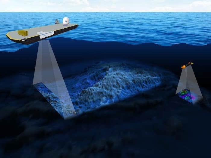
Seabed 2030 uses multibeam bathymetry data collection. “You can get very high resolution, down to centimeters, if you bring the sonar very close to the bottom,” says Larry Mayer.GEBCO Nautilus Members enjoy an ad-free experience. Log in or Join now . Larry Mayer, a marine geophysicist, gets shivers when he looks at a night sky […]