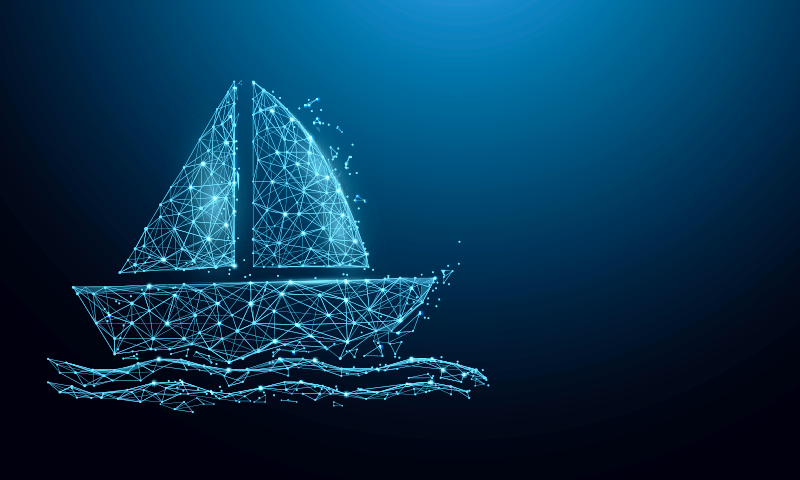
Earlier this year, Bjorn Bergman noticed something odd about a fishing ship off the coast of Mauritania.
Like other large ships in those heavily fished waters, this trawler broadcasted Automatic Identification System (AIS) radio signals. AIS information contains a ship’s name, location, speed, and course—invaluable data to help nearby vessels safely avoid one another. All larger ships are required by international law to use AIS for navigation, and the data is also useful for organizations who monitor fishing.
But this trawler’s AIS feed was weird. Instead of showing a constant track as it slowly deployed its nets, the ship appeared to be jumping impossible distances in the blink of an eye. Here one second, miles away the next. “From looking at the data, they’re mixing false and real tracks in a pretty confusing way,” says Bergman, an ocean analyst at SkyTruth, a non-profit that uses satellite technology to pursue environmental justice.
Bergman is still investigating the mystery of the teleporting trawler, but he suspects it could be the first hard evidence of something he has long feared: the arrival of sophisticated technology enabling unscrupulous vessels to carry out environmentally destructive fishing under the cover of digital alibis that place them hundreds of miles away.
Whether they get away with it or not could come down to systems that Bergman and others are now building to stay one step ahead of the rule-breaking ghost ships. “There are always going to be challenges with certain actors trying to hide what they’re doing,” says Jennifer Raynor, a natural resource economist at the University of Wisconsin-Madison. “But the more we know, the better we can do.”
The ship appeared to be jumping impossible distances in the blink of an eye.
It’s no secret that the ocean is in crisis. Marine life is squeezed between climate change, acidification, and over-fishing. More than one-third of fish populations are being caught at unsustainable levels—a number that has doubled since the 1980s—which pressures fishing vessels to travel farther, and increasingly to bend or break rules to land their catch. As for the trawler off Mauritania, it was likely hunting for sardinella, a beautiful silvery species whose populations have been overfished to the point of collapse; they’re typically processed into feed for aquaculture and livestock in Europe, the United States, and China.
Historically, there was little way to track those ships. Captain’s log books are unreliable; and putting government observers on board every ship is unaffordable. (It can also be dangerous for the observers.) That changed in the early 2000s with AIS, which broadcasts unencrypted radio signals that are easily recorded within a distance of about 20 miles. Most moving ships send out AIS chirps every few seconds.
Suddenly ships could be tracked—within a few miles of major ports and coastlines, that is. The movement of ships in the open ocean remained mysterious. Conservationists trying to monitor unauthorized and illegal fishing in marine reserves and protected areas, often far from human infrastructure, still had few ways of doing so. Then came the satellite revolution. Suddenly, cheap miniature satellites lofted in large numbers into low Earth orbit unlocked new ways of looking at the planet. The same companies running terrestrial AIS recorders realized they could now track ships almost anywhere on Earth. And fishery activists were right behind.
The most ambitious of these is Global Fishing Watch, which was founded in 2015 as collaboration between SkyTruth, ocean conservation nonprofit Oceana, and Google. Using satellite data, it started to piece together a truly global map of AIS tracks. “When the AIS data set first came out, there was no reason for captains to think that anyone was watching them and so they were just doing whatever they were doing,” says Raynor. “It was transformative.”
Now ships knew they had eyes on them—but they adapted. Using the Global Fishing Watch data, Oceana soon described multiple cases of fishing vessels turning off their AIS, including two Spanish ships that went dark off West Africa. Although ships are allowed to briefly silence their AIS systems if they fear attack, these did so for days at time over a period of months, during which there was no record of where they might have gone. Oceana also identified other vessels similarly turning off AIS near marine reserves in the Galapagos Islands and the Indian Ocean. Although not conclusive evidence of wrongdoing, it was extremely suggestive—and led to fines for the Spanish ships.
But what if instead of disappearing completely, illegal fishing vessels could fake their location to make it seem as though they never entered protected areas? Late in 2022, Bergman unmasked a Russian oil tanker that appeared to be sending false coordinates via AIS, probably to carry out a sanctions-busting mid-ocean transfer of crude oil near Malta. While AIS tracks showed two tankers nearly 10 miles apart, in reality they were almost touching.
The fictitious data marked a step-change in how researchers could rely on AIS. “Having no data might in some cases be easier than having bad data,” says Raynor. If ships just go dark, it’s a clear signal to activists that something is going on. If they subtly spoof their location instead, their activities could remain hidden in an ocean of data.
What if instead of disappearing completely, illegal fishing vessels could fake their location?
But Bergman is already one step ahead. In his work on oil tankers, Bergman noticed that fake AIS tracks often lack the normal variations in course and speed of genuine sailings. They are also sometimes detected by satellites that could not possibly have received the signals if they were genuine. And his latest weapon against spoofers is the most powerful: the European Space Agency’s Sentinel-1 satellites. These orbit the world twice each week, using sophisticated radar systems to map vegetation, track sea ice, and, incidentally, detect ships longer than about 65 feet. By comparing Sentinel-1 images to the AIS data, Bergman could work out the oil tankers’ actual locations.
“This kind of subtle manipulation is interesting because it’s hard to detect and I think it’s mostly going undetected,” says Bergman. He identified similarly spoofed AIS tanker tracks in the Mediterranean, the Persian Gulf, and near Venezuela. Next he automated the process, building a system that correlates vessel positions from Sentinel-1 satellites with AIS data. It was this system that flagged the trawler off Mauritania—and many others.
“There’s clearly software that’s proliferating to enable this deception,” he says. “And we’re seeing particular ships coming up again and again.”
In January, Global Fishing Watch and SkyTruth published a paper in Nature, with Raynor as a co-author, summarizing their work. The organizations estimated that about 75 percent of the world’s industrial fishing vessels are not currently tracked in AIS databases, with the problem most pronounced near Africa and South Asia. About 25 percent of ships used to transport goods and fuel are also not being publicly tracked. This was almost entirely due to AIS systems being turned off rather than spoofed, but it shows the scale of the problem.
I asked Bergman if AIS is now irredeemably hacked or if it can somehow be salvaged. Like a Russian tanker in the Mediterranean, “it’s going in both directions at the same time,” he says. There are technical solutions on the horizon that could validate AIS using cryptography “but you’re also talking about 200,000 ships globally. That’s going to take a really long time to change over.”
In the meantime, Bergman and his satellites will keep policing the world’s seas from the skies above. His next step is integrating high-resolution optical imagery from the European Sentinel-2 satellites; one of his first targets will be the teleporting trawler in Mauritania.
This ability to bring more and smarter systems to bear keeps Raynor upbeat about the future of tracking illegal fishing. “You can imagine these technologies like pieces of Swiss cheese on top of each other,” she says. “Each one has holes—but the more pieces you lay on top of each other, the more holes are covered.” 
Lead image: Illus_man / Shutterstock