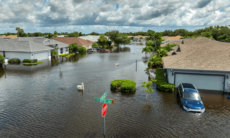
You likely have just the tool you need to keep your community whole in the wake of a hurricane—in your pocket. With just a smartphone, you can snap photos in your area to provide crucial data to scientists and disaster response teams, helping them react more quickly and effectively when these natural disasters strike.
While these experts rely on technologies like weather radar and satellite imagery, they tend to lack detailed information from people on the ground. That’s why NASA, in collaboration with GLOBE, an international community science program, invites us to join its Response Mappers team, an initiative aiming to pinpoint shifts in land cover before and after hurricanes through crowdsourced data. You can get involved by downloading the GLOBE Observer app and joining the NASA Response Mappers team.
By regularly documenting the same spots in your neighborhood, anywhere from once a week to once a month, hurricane response experts get a much-needed close-up look at the typical conditions—from your local flora to high-rises. While the project kicked off earlier this summer, NASA is seeking data through October 31, near the end of the Atlantic hurricane season.
The project is centered around the southeastern United States, where hurricanes tend to land, but anyone is welcome to submit their snaps to boost future recovery and research efforts. This work is especially urgent as climate change raises the chances of quickly intensifying storms, and sea level rise worsens storm surge flooding.
“Citizen science gives us ground truth,” said Joshua Barnes, manager for NASA’s Disasters Response Coordination System, in a statement. “The more eyes on the ground, the better we can serve communities in need.”
In the aftermath of a storm, your images can alert emergency responders to areas that require cleanup—but NASA emphasizes that Response Mappers participants should only venture out in safe conditions. This information is added to an open data set that can be wielded to verify satellite images, gauge the extent of damage, and inform future research, such as studies on how healthy wetlands can ease the impacts of floods. GLOBE and NASA are also working to help participants track their data’s journey by creating observation maps.
“At the end of the season, we hope to tell a story that begins with everyday people helping NASA deliver life-saving insights,” Barnes said. “And it can all start with a photo.”
Learn more about the project here. 
Lead image: Bilanol / Shutterstock