
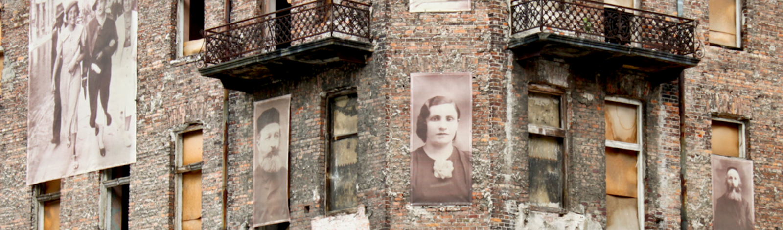

On a trip to Warsaw, Poland, in 2019, Richard Freund confronted the history of resistance against the Nazis at a Holiday Inn. Freund, an archaeologist, and professor of Jewish Studies at Christopher Newport University in Virginia, was led by the hotel manager into the basement. “Lo and behold,” Freund says, a section of the Warsaw Ghetto wall was visible. Freund was in Warsaw accompanied by scientists from Geoscientists without Borders, a nonprofit group whose mission includes investigating archaeological sites and working to mitigate natural disasters like earthquakes and tsunamis.
The geoscientists were helping Freund pinpoint the location and contents of underground bunkers, where hundreds of Nazi resisters, led by 24-year-old Mordechai Anielewicz and his girlfriend Mira Fuchrer, plotted to combat the deportation of Jews to death camps. The rebellion erupted in the Warsaw Ghetto Uprising of 1943, the largest Jewish revolt in World War II. The resistance lasted nearly a month. During the battles, Nazis funneled poison gas into the underground bunkers, killing many of the rebels and driving others to escape through sewer tunnels. The Nazis crushed the uprising and razed the Warsaw ghetto. Tens of thousands of Jews either died in the battles, were executed, or were deported to death camps.
The history of the uprising was written in part by those who escaped. “They tell us what happened in that final moment,” says Freund, who has led archaeological investigations into Jewish history in Israel and Europe. But the story of the Warsaw uprising, and the Holocaust, is not complete. Holocaust survivors and their stories are dwindling. Now geoscientists have stepped in to fill in the historical gaps. By employing geophysical mapping and soil sampling, among other techniques, they have located mass grave sites—there are an estimated 200 such sites in Lithuania alone—corroborated testimonies of daring escapes, and unearthed the remains of a once-thriving culture.
This summer, Freund plans to tread carefully beneath underground sewer lines in Warsaw to explore Mila 18, or “Street 18,” the bunker that served as the headquarters for the Ghetto resistance fighters. Determining what remains in the bunker is difficult. When Warsaw was rebuilt after the war in the Soviet era, they tamped down the remains, poured cement for a foundation, and built on top. Thanks to a technique that images the subsurface after an electrical current is passed through—Freund calls it “pinpoint archaeology”—geoscientists identified metal objects in the bunker. Freund is anxious to discover if the metal is sewer pipes or could be stoves the fighters used to keep warm, reinforce tunnel walls, or even be arms caches.
“Science is the next frontier that will speak about these sites,” Freund says. Geophysical techniques provide a way to locate and preserve sites that have been built over, as is often the case in Holocaust sites across Europe, even locating them under the canopy of vegetation. While certain sites will be excavated, the process of discovering them does not have to be destructive, as with traditional archaeology. Using non-invasive techniques means archaeologists can hold history in situ. Such non-invasive methods are a matter of being sensitive, too. “These are mass graves of people who are victims,” Freund says. “They have been victimized once and we don’t want to disturb them again by disturbing their burials.”
The Great Synagogue in Vilnius, Lithuania, was a legendary house of prayer known as “Jerusalem of the North.” It was built of wood in the 1500s and revamped by Italian architects with brick in the 1700s. The synagogue was part of a complex with a library, study rooms for scholars, and ritual baths with a stove for heating the water. The synagogue also had a secret. To circumvent an ecclesiastical rule that forbade buildings higher than the local church, “the Jews, instead of building up, built down,” Freund says. Worshipers walked down two flights of stairs to get to the main hall. When they looked up, the synagogue was five storeys high.
The story of the Warsaw uprising, and the Holocaust, is not complete. Now geoscientists have stepped in to fill in the historical gaps.
During a rampage, Nazis burned down the synagogue. After the war, the Soviets laid a cement foundation on the area and built a school and playground on top of it. In 2015, Jon Seligman of the Israel Antiquities Authority, whose family was from Lithuania, instigated a search. He enlisted physical geographer Harry Jol of the University of Wisconsin Eu Claire. Jol began a search on the playground with ground-penetrating radar. The device emits an electromagnetic pulse and records the echo among the subsurface stratification, building an image of the underground. The technique played a crucial role in convincing the authorities to allow excavation on the school premises.
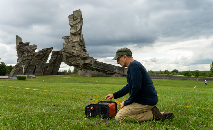
Paul Bauman, technical director of geophysics at Advisian, a consulting firm, led further explorations of the site. (In 2020, Advisian, with support provided by Geoscientists without Borders, published a report of the geoscientists’ investigations of Holocaust sites—a key source for this article.) What worked in the geoscientists’ favor, Bauman says, is the composition of the Earth in Lithuania. It’s a relatively homogenous subsurface comprised of glacial fluvial outwash. Much of the Baltics “is a bit of a giant sandbox,” he says. “That makes it well-suited to radar,” which has an easier time identifying anomalies because “anything that wasn’t sand really stood out.”
Employing techniques of electrical resistivity tomography and “induced polarization,” Bauman and his colleagues located precise targets for the archaeologists. Induced polarization images the subsurface in terms of its “chargeability.” Chargeability is loosely the ability of the subsurface to store charge, even if it is for milliseconds. This is useful for pinpointing metal objects, such as a heating stove, which geoscientists discovered at the Great Synagogue. In the chargeability plots made by the geophysicists before excavations, the metal object stands out at a particular depth. In “resistivity” plots, on the other hand, so-called “void spaces” show up. At the Great Synagogue, such void spaces, “a lot of air space with collapsed debris,” Bauman says, corresponded to a cellar under the synagogue’s Bimah or altar.
Discoveries made in the area include a Hebrew inscription incised with gold-fleck still on the letters, coins dating from Napoleonic times, tiles with decorations, a petal of a metal candelabrum, and a book stuck into a wall. Exploration continues this summer. Freund says he hopes to discover the contours of the original wood construction. “You’re looking at time capsules below the surface, and each one of them tells you about the population of Jews within that time,” he says.
Most of these time capsules tell horrific stories. On a cold and cloudy summer day in 2019, Bauman collected soil samples from mass graves in Kaunas, Lithuania. He was working in an area known as the “Battlefield,” fallow land at Fort IX. When Lithuania was under Tsarist Russia rule, it constructed nine forts to barricade the city from Prussian invasions. In their stampede across Europe, Nazis took over Fort IX and turned it into a “death fort,” where they killed 50,000 Jews. Survivors describe 14 burial trenches with 3,000 to 4,000 murdered victims in each one. Working in the area, which today is an open park, “was something very sensitive,” Bauman says. “We had to ask permission from the museum and the Jewish community because we didn’t want to disturb the burials.”
Bauman was attempting to “distinguish areas of mass graves from background areas.” A map of the burial trenches was available from Soviet excavations carried out in the 1960s, but their precise locations were unclear. “We know historically people would wander that field and see bone and ash,” he says.
There were no coffins or caskets in the Battlefield for the geoscientists to target with electronic equipment. Tens of thousands of the bodies had been exhumed, their bones crushed and their ashes scattered by the Nazis. Remnants, such as bullets and casings, tin cups, knives, spoons, combs, wire frames for spectacles, and a rare passport with a photograph, had been found earlier. Postwar, a Soviet-era monument was constructed.
Science is the next frontier that will speak about these sites.
Bauman employed a process that identified phosphorus concentrations in the ground. The process was less familiar to him and he relied on email advice from archaeological phosphate expert Johanna Ullrich O’Keeffe. Phosphates tend to bind to receptors in the soil. The greater the clay component in the soil, the more receptor sites are available. Phosphate retention is lost in extremely sandy soils, but there was still leeway at Fort IX. Burials would deposit phosphates in organic form. Over time, these organic phosphates mineralize as they remain in the soil.
Although it had only been 78 years since the mass burials in the Battlefield, the geoscientists figured the phosphorus process would help locate them. Mineralization begins immediately after burial, and generally takes about 200 years, but the process of phosphorus release is accelerated by burning and crushing. That made it likelier for geoscientists to see a “phosphorus shadow” in the topsoil. Grass or plants will draw the phosphorus up from the soil column to shallower depths. “You can just sample down to 20 centimeters and capture the indications of higher phosphates,” Bauman says. Indeed, nine of the 14 trenches corresponded to high levels of phosphorus, corroborating survivors’ testimonies that the area was a graveyard of Nazi murder victims.
Holocaust survivors tell another harrowing story about Fort IX. In August, 1943, the Kaunas gestapo received Sonderaktion (special action) 1005 from Berlin. Anticipating Nazi retreat from the Baltic states, the order was to eradicate the mass graves by January, 1944. Seventy-five prisoners at the fort were pressed to carry out the order. They included former Ghetto inmates and Red Army prisoners of war. Sixty-four prisoners became the “Burning Brigade.” Mikhail Geltrunk, a survivor, testified in 1946, “We exhumed and burned 600 bodies a day. That was the quota fixed by the Germans. Two huge pyres with 300 bodies in each were burned every day. After the bodies had been burned the bones were crushed with metal tools and buried.” After the ashes and crushed bones were buried, another survivor said, “the Hitlerites filled in the ditches, plowed up and sowed the field.”
While the awful work was underway, the prisoners in the Burning Brigade were planning an escape. On Christmas Eve, 1943, with the lights out and the guards leaving for a night of revelry, the escape began. Lithuanians had built cement tunnels beneath the fort before the war. From their locked cells, the prisoners reached a tunnel with a locked door. They broke through the door and clambered through another tunnel to reach the inner yard of the prison. The escapees clambered up a wooden ladder placed in a wall and utilized a makeshift ladder to get over the barbed wire on top of the prison wall, across a moat, and into an open field. The daring escape was completed by Christmas morning.
While Fort IX holds several artefacts to commemorate the escape, details need to be filled in. The geoscientists know the direction the escapees fled, and this summer aim to track their escape using multispectral cameras mounted on drones. The green spectral band in images taken by the drone may correlate with vegetation stress. This may be due to buried construction material that has limited root growth. Unusually healthy vegetation due to a trench, which may be capturing more moisture and nutrients, would be indicated as well. The geoscientists want to find the hiding areas the escapees may have used in the nearby forest.
Geoscientists have another ambitious project planned for this summer—searching for a lost cache of information about Nazi crimes and Jewish heroes in Warsaw. Between 1940 and 1943, an organized underground operation, comprising dozens of contributors, collected thousands of documents: photographs, drawings, writings, journals and tabulations, signed and dated. They put them into 2-feet-high metal milk cans and metal boxes, and buried them in the Warsaw Ghetto. Called the Ringelblum archives after historian Emanuel Ringelblum, the caches were buried in three different locations. In 1946, a survivor found the first of the milk cans. According to Freund, the archives were used as evidence in the Nuremberg trials. The second part was discovered in 1950. The archives were used in the trial of Adolf Eichmann in 1961. No one has found the third cache.
Today, Freund and the geoscientists are working with the Warsaw Ghetto museum to find the third cache of the Ringelblum archives, which they expect is stored in a metal milk can. They know how deep the can is planted and where it was last seen. Uncovering the cache would be another chapter in the Holocaust story, and further testament to science helping get history right.
Virat Markandeya is a science writer based in Delhi.
Lead image: Anastasia Petrova / Shutterstock
Support for this article was provided by the American Geosciences Institute. Read more on the Nautilus channel, Earth.