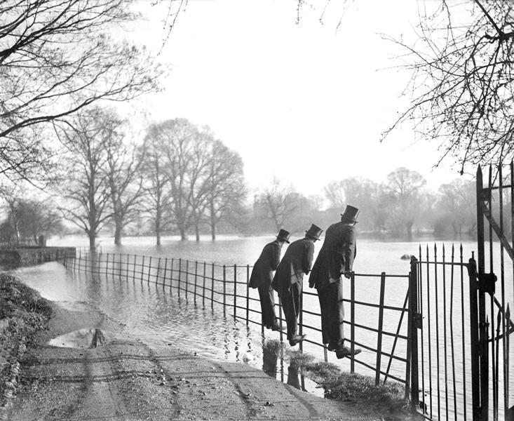
Unusually heavy winter rains have flooded the town of Chertsey, west of London, twice in the past three years. Only its old center—a raised plot on the bank of the River Thames where Anglo-Saxon monks built an abbey in the seventh century—has remained consistently dry. For most residents, the rising waters, often stinking with sewage, have come as an unwelcome surprise after centuries of a relatively dry, stable climate. They seem to have forgotten, or perhaps never knew, this telling fact about the place they call home: In Old English, Chertsey means “Ceorot’s island.”
The name harkens back to the Early Medieval Period, when Germanic tribes began to settle, and name, many of the places dotting maps of modern Britain. Back then, water was ubiquitous. Sediment deposits dating to this era paint a picture of overtopped riverbanks and runoff rushing down slopes. “Anglo-Saxon England was a water world,” says Richard Jones, a landscape historian at the University of Leicester. He studies how early English settlers used place names, or toponyms, to encode practical information about their watery environment. For instance, Byfleet, a village in southern England, indicates a “tidal creek,” or “estuary”; Buildwas, in the west, describes “land subject to rapid flooding and draining”; and Averham, in the east, a “settlement at the floods.”1

But starting around the 11th century, the British landscape got drier as its climate stabilized and glaciation drew moisture from the biosphere, and many of these toponyms lost their original meaning. Development spread from “island” sanctuaries like Chertsey Abbey into newly parched floodplains once composed of forests, fields, and marshes. Over time, Britons’ close relationship with water, and their deep understanding of its patterns, dried up with the land.
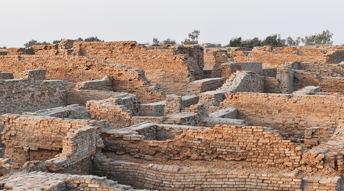
The names of these doomed places will bring to mind the single most salient fact about them: They are gone.
Now, as the planet warms, Britain may be returning to a wetter, more volatile climate. In the last decade, England and Wales have seen some of the worst flooding on record. And as winter storms get stronger and more frequent, often swelling rivers and tributaries beyond their capacity, Chertsey and other waterlogged places are reclaiming their medieval identities. “These names are once again accurately describing the behavior of water in England,” Jones says.
Beyond offering a glimpse into past landscapes, he argues, toponyms could help today’s communities adapt to their changing environment. “We may have a lot to learn from the Anglo Saxons and their ability to live in a watery place,” Jones says. Their knowledge, preserved in names passed down over centuries, could inform where urban planners build new subdivisions, install barriers or drainage systems, or restore wetlands.
Perhaps by examining our past, we can better prepare for the future.
Place names are among the things that link men most intimately with their territory,” wrote British archeologist Jacquetta Hawkes in 1951. “As the generations pass on these names from one to the other, successive tongues wear away the syllables just as water and wind smooth the rocks.” The English toponymist Margaret Gelling called these timeworn names “signposts to the past,” as they have long guided scientists in reconstructing forgotten histories and landscapes. Where you find a form of the Old English weard-setl, for example, you will likely find a place where a “guard house” once stood. Likewise, ceaster identifies the site of a “walled town,” hlæw a “burial mound,” æcer a “plot of cultivated land.”
But researchers like Jones are finding that place names can also be used to track environmental change. In a 2010 study of wetlands along the coast of southwest Spain, scientists analyzed some 700 toponyms on maps dating to 1869. From ecological records, such as naturalist accounts, aerial and satellite photographs, and rain and temperature measurements, they knew that the land had gotten drier, starting around the mid-20th century. After the Spanish Civil War, which ended in 1939, the government, facing a resource shortage, aggressively planted pine and eucalyptus trees in this strip of mosquito-ridden bogs and brooks. The new managed forests, along with reduced rainfall and warmer temperatures, gradually sapped moisture from the soil.
And as water features shrank or disappeared, their names changed too: Arroyo Harinoso (Floury Brook) became Arroyo del Pino (Pine Brook); Laguna de la Higueruela (Stinking Clover Lagoon), once one of the region’s largest peat bogs, was reduced to a smattering of small water holes, including Reedy Lagoon, Moor Thicket Lagoon, and Puddles. Local toponyms can thus provide a detailed and enduring portrait of a landscape in flux, the researchers argued in the journal Climatic Change. “Although they cannot be used as proxy data”—data gathered from natural resources such as sediments, tree rings, and fossil pollen—“they can be used to mark climate changes or turning points,” they wrote.1
“As modern western society has turned its back on the landscape, place names have become little more than convenient geographical tags.”
Another study, published in 2007, found that toponyms can offer a quick, reliable record of how animal populations shift over time. For nearly two decades beginning in 1985, Swedish ecologist Johan Spens sought to reconstruct the distribution of brown trout in northern Sweden over the past three centuries using historic maps, interviews with local fishermen and fishing-rights owners, and gillnet surveys. Talking to an elder fisherman, he was surprised to learn that an old traditional name for this species was Rӧ, a common prefix of lake names in the area. Comparing these toponyms to population data, he found that nearly one-third of all lakes with past or current brown trout populations included Rö in their names—Rödingtjärnen, for instance. Even more remarkable, any given Rö lake had a 92 percent chance of containing brown trout at one time or another. (The odds were only 11 percent for any random lake, Rö or no Rö.)

Spens concluded that lake names could help identify historic trout populations that have since gone extinct, as well as the disturbances, such as from predators or human industry, that led to their decline. Lake names, he proposed, could also help guide modern population surveys, allowing ecologists to accomplish in a couple of months what would typically take five years using random sampling. “With the Rö-names,” he wrote, “fishers from hundreds of years back in time are communicating to us and saying: ‘This lake is characterized by its richness in brown trout. There are good habitat conditions for this species here.’ ”2
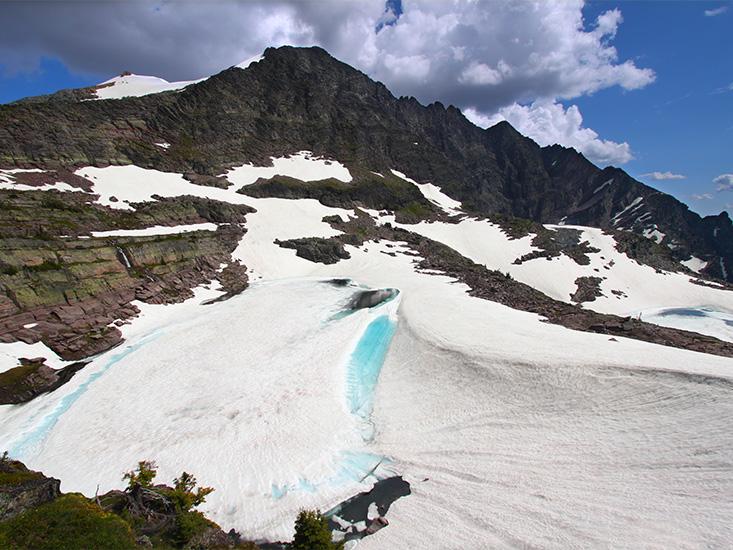
The meanings and messages behind toponyms will become increasingly significant as global warming and other environmental changes render many of them obsolete. In Montana, for instance, Glacier National Park, which had 150 glaciers in the mid-1800s, at the end of the Little Ice Age, now has 25 and will probably have none by 2030. In Barrow, Alaska, whose centuries-old Inuit name, Ukpeagvik, means “the place where we hunt snowy owls,” the species’ numbers appear to be declining, according to ornithologist Denver Holt, who has observed wildlife in the area for 25 years. And in northeast Siberia, there is a bulge in the Kolyma River called Kray Lesa (“Forrest’s Edge”), which once marked the border between the boreal forest and tundra. But in recent decades, as average temperatures have risen, that boundary has shifted a dozen or so miles north.
Other places, including coastal towns and island nations, are slowly disappearing as sea level rises and the land sinks. One day in the not-so-far future, the names of these doomed places will bring to mind the single most salient fact about them: They are gone.
It was the winter rains of 2007, which brought some of the worst flooding in a century to southern England, that sparked Jones’ interest in British toponyms. At the time, he was pursuing a lectureship at the University of Leicester—where he now works—and was casting around for a research program to propose. With the floods on his mind, his thoughts turned to the subject of his undergraduate thesis: a medieval monastery in the village of Buildwas, recently drenched by the overflowing River Severn.
Poking into the town’s history, he learned that the suffix of its name, was, from the Old English waess, means “land that floods and drains quickly.” He knew that this root shows up in many other place names and began to look into their etymology. He learned, for example, that Arley meant a “woodland clearing where eagles could be found,” and that Alderwasley designated a “pasture with alder trees where water can fill and drain.” In medieval times, myriad marshes and woodlands along a river’s edge helped absorb floodwater.
Jones had found his project: He would decipher and map the Old English names that identify modern Britain in hopes of gaining insight into Anglo Saxons’ relationship to the land. How, for instance, had these early settlers, who had built a monastery in a floodplain, managed to thrive so close to water—a resource that was crucial for travel, for farming, and for powering mills, but was often destructive and unpredictable?

One option was to control the water’s behavior. Some communities built flood banks and dykes, or set aside undeveloped land to serve as so-called water meadows, which soaked up floodwater like sponges. Another option was to settle in the highlands, away from water. But Jones, who had landed the teaching job, was struck by the fact that the Anglo Saxons mostly did neither. “Over time, they established the high water mark,” he observes, and then “they located themselves just above it without the need for more defenses.” Sometimes the difference between safety and submersion was just a few centimeters.
In lieu of modern mapping tools like lidar, the Anglo-Saxons simply read the landscape and grew to know it intimately. “Anglo-Saxon society was a more naturalistic world in which people were fully immersed and embodied in their environment,” Jones wrote in an unpublished paper. “Modern western society,” he laments, “has turned its back on the landscape.” And as a result, “place names have become little more than convenient geographical tags.”
“Everyone knows that our Prime Minister attended Eton College,” Jones told me. “But I’d bet my bottom dollar that very few know that Eton means ‘river settlement’ even if they know that it is on the floodplain of the River Thames.” Nor does the average visitor to Stockholm know that its name denotes “log islet.” Or that Dublin means “black pool.”
At the same time, the technical language that bureaucrats often use to warn the public about flood risk may be further alienating Britons from their environment, says John Curtin, Director of Incident Management and Resilience at the United Kingdom’s Environment Agency. In public workshops, for example, the Agency was surprised that participants rated “abstraction and flow” as less significant than other water management issues, including chemical pollutants and sewage treatment. The workshops’ organizers wondered if the problem might be the terminology. “It would have been interesting to see what would have changed if [abstraction and flow] had been called ‘water supply’ or ‘availability of water,’ ” they wrote in a report.3
“The language that experts like me are using to describe the science is becoming a barrier to people’s understanding of risk,” Curtin says. According to the Agency, one in six homes in England are currently at risk of flooding from river swells or coastal surges, but surveys show that only 5 to 8 percent believe it. “We have a large at-risk population, but only a small population of them understand that,” Curtin says. He applauds Jones’ efforts to “connect people to the nature around them” and “bring back that awareness of place.”
Together with colleagues, Jones plans to apply for a grant to test, using soil sampling, how closely place names actually reflect historic ecological features and events. Was Alderwasley really a water sink? Did Broadwas represent a wide land that flooded and drained? Was the River Blythe (“easygoing”) calm and the River Bollin (“noisy”) tumultuous?
Jones hopes that the results will inform studies of past ecologies while also helping to mitigate flood risk in modern times. Many clearings on the outskirts of British towns, for example, have the name hamm feld (“island field”), suggesting they once attracted floodwaters. If that’s true, Jones says, they could be good places to restore wetlands, which can absorb water that would otherwise pool in buildings and streets.
But Jones would be satisfied if his work simply made his countrymen more aware of their homes’ hydrological legacy. “I live in a place called Upton, which is just that,” he says. The town lies three miles away from low-lying Averham (“settlement at the floods”). “I get the impression that had the residents of Averham known what their name implied, they might now be my neighbors.”
Eli Kintisch, a correspondent for Science magazine, writes about the Arctic, climate change, and oceans.
References
1. Sousa, A. Garcia-Murillo, P., Sahin, S., Morales, J., & Garcia-Barron, L. Wetland place names as indicators of recent climate change in SW Spain (Donana Natural Park). Climatic Change 100, 525-557 (2010).
2. Fishers’ Knowledge in Fisheries Science and Management. United Nations Educational, Scientific and Cultural Organization. www.unesco.org (2007).
3. Public dialogue on Significant Water Management Issues. Environment Agency. www.gov.uk (2014).