

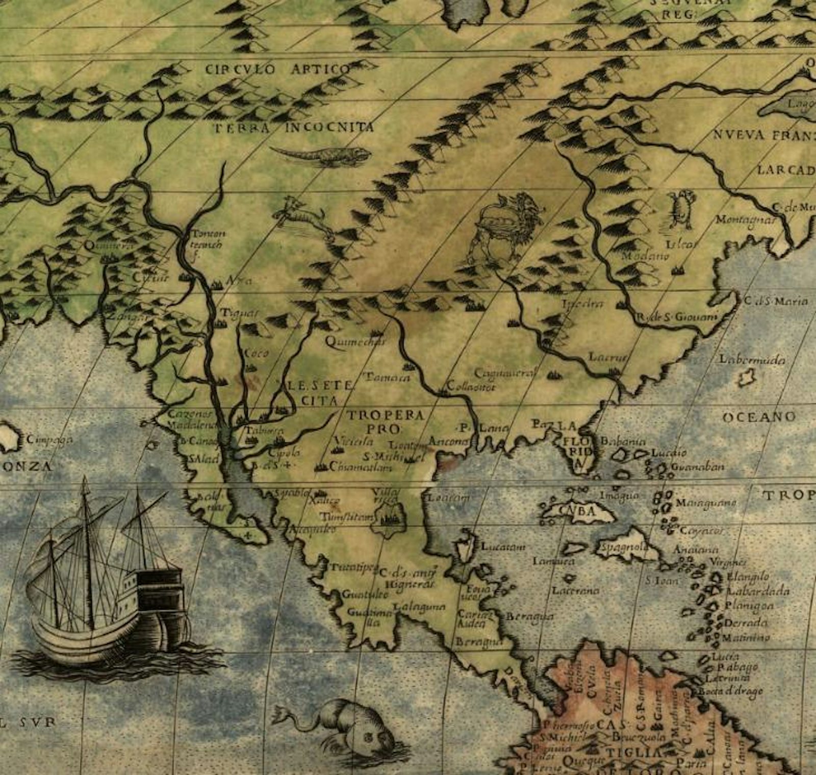

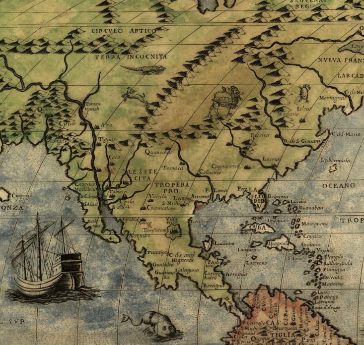
Terra incognita. Unknown land. You may be familiar with this Latin phrase, which most notably appears on old maps, sometimes next to images of dragons, fantastical sea creatures, or other monsters. Cartographers once vilified the unknown—to warn sailors and travelers of uncharted territories, and to signal that danger lay beyond the sanctuary of home. Science-fiction writer Margaret Atwood draws an analogy between maps and human knowledge (In Other Worlds, 2011):
“With every map there’s an edge—a border between the known and the unknown […] And that’s what’s scary about darkness for a lot of people: the unknown. The known is finite, the unknown is infinite: anything at all may lurk in it.”
But imagine for a moment that you didn’t have to rely on maps to navigate the unknown—that your memory, instincts, and knowledge of the environment sufficed. This is the art of Polynesian wayfinding.
Where a layperson might look at the ocean and see an indecipherable nothingness, a Polynesian wayfinder would know just how to chart the way home.
Origin stories
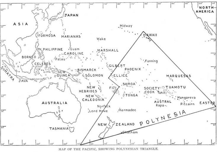
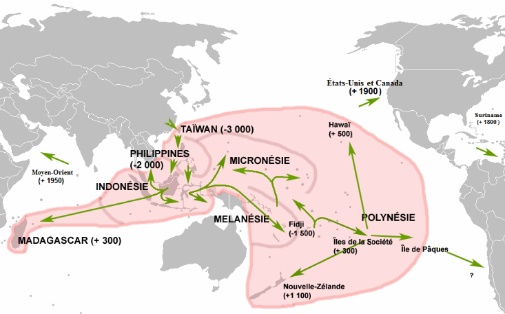
Although there are a few theories about how the Polynesians spread out among the islands, there is linguistic, anthropological, and DNA evidence to support that the first Polynesians originated from seafaring Austronesians, who trace their prehistoric origins (somewhere between 5,000 and 3,000 years ago) back to present-day Taiwan. From there they spread through the entire Polynesian Triangle, a huge part of the Pacific Ocean including over 1,000 islands, with the three main “points” at New Zealand, Hawaii, and Easter Island. Lacking instruments like compasses or astrolabes, wayfinders were still able to navigate and discover islands thousands of miles away, then return exactly to their points of origin. This allowed Polynesians to migrate to and travel between island groups with relative ease, expanding their population across an area that spans a total distance of 10 million square miles of water, slightly larger than the size of Canada.
What was the motivation behind risking these long journeys at sea with no guarantee of finding land or even being able to come back at all? Some did it for status: Those who discovered islands would achieve higher social standing. Others did it for survival: They were in search of resources that were not native to their own islands. No matter the incentive, the search for islands became embedded in Polynesian culture and lore, and so too was wayfinding.
A guide to wayfinding
“To navigate, you must be brave and you must remember.”
—Mau Piailug, Micronesian navigator
Ancient Polynesians relied on three core faculties to navigate: knowledge of the stars, understanding of the environment, and—above all—their memories.
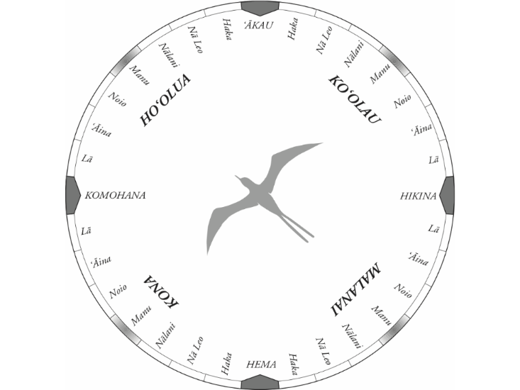
Stars: Polynesians noticed that each star and constellation would predictably rise in one spot of the sky and set somewhere on the other side. Exactly where they went up and down depended on the season and the latitude. One could always count on the Big Dipper rising at a certain position during the summer at a certain island, then setting opposite from that position, for example. Wayfinders classify the most visible stars in the night sky into “houses,” or sections of the sky, to help track their locations. The houses are then organized into quadrants that match the cardinal directions, as shown in the star compass below. By memorizing hundreds of stars and their positions relative to the horizon, wayfinders were always able to assess what constellations looked like at their points of origin using that as a reference point for latitude when they were out at sea.
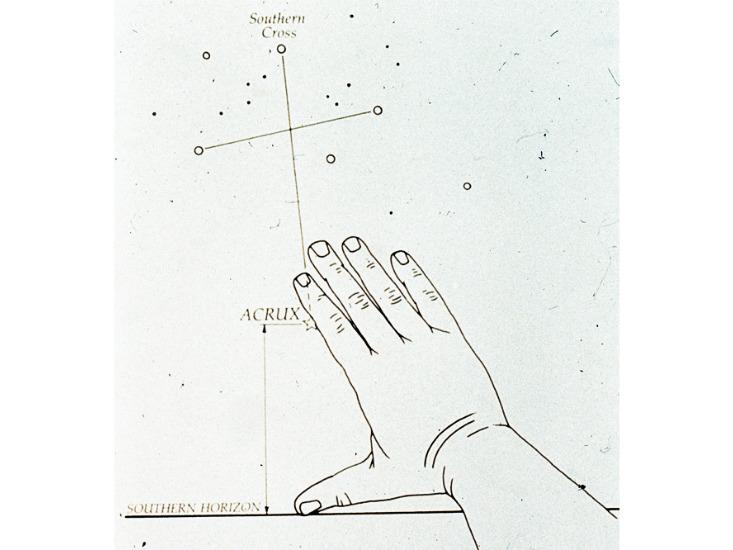
Imagine for a moment that you live in Hawai’i. At that latitude, when the constellation Hānaiakamalama (which we know as the Southern Cross in English), is at its highest in the sky, the distance between the top star and bottom star is equal to the distance between the bottom star and the horizon, or 6°. If you travel south from Hawai’I, the Southern Cross rises higher in the sky; move north and goes down toward the horizon. (This is roughly analogous to how traffic lights seem to move up as you drive toward them and down as you drive away.)
Without instruments, wayfinders could use simple hand calibration methods, using different hand positions, to assess how far stars and constellations were from the horizon. Combining this trick and their mental encyclopedia of star locations, wayfarers could keep tabs of their latitude.
Environment: Even without navigation instruments, a navigator can still make useful observations about wind and sea currents, clouds, and marine life to approximate how close an island could be. Following simple wave physics, the presence of an island will often alter the direction of a wave as it passes around the landmass. Wayfarers would pay close attention to how wind direction compared to current direction; generally, wind and current will go the same way unless a nearby island is disrupting the current.
Sightings of particular things like driftwood or certain birds usually mean there is land nearby. Some wayfarers even cite cloud color as an indicator of whether there is land beneath it, as land and lagoons can reflect a slightly different color upward than open ocean waters.
Memory: The revered wayfinders say that most important rule of Polynesian navigation is this: “Remember everything.” The only way to find your way back home is to remember how you got to where you are in the first place—every course adjustment, every wind change, every constellation. On each boat crew, a designated navigator sits, foregoing any type of distraction—even sleep—in order to interpret and memorize all external conditions such as wind and sea current, changes in boat direction, etc. Mau Piailug, Micronesian wayfinder jokes that if you ever want to spot a wayfinder, “Look for the red eyes.” For ancient wayfinders, there were no maps, pens, or paper to record the trajectory of the trip, nor any other instruments other than markings on the boat to reference star positions, so this role was one of the most demanding jobs of all.
Today’s sophisticated navigation tools, especially the advent of GPS, leave little uncharted territory. While that may come with a tinge of disappointment to the natural-born adventurer, the history and continued practice of Polynesian navigation, as passed on from older wayfinders to younger ones, is a reminder of what humans are capable of. Perhaps an even greater challenge, then, would be to cast away our tools, even if temporarily, to find our way back to such navigational skill once again.
Further reading:
Bellwood, Peter. “A Hypothesis for Austronesian Origins.” 1988.
Gladwin, Thomas. East is a Big Bird. Harvard University Press, Jun 30, 2009.
Notes on the Discovery and Settlement of Polynesia
Wayfinders, PBS (documentary)
Lily Bui is a researcher at MIT’s Comparative Media Studies program. She’s interested in everything.